
Make a donation
Gear up for your next adventure:
As an Amazon Associate, this site earns from qualifying purchases at no extra cost to you.
Snaaskerke topographic map
Click on the map to display elevation.
Make a donation
Gear up for your next adventure:
As an Amazon Associate, this site earns from qualifying purchases at no extra cost to you.
Snaaskerke
Snaaskerke is een landbouwdorp dat ligt in het West-Vlaams poldergebied op een hoogte van ongeveer 2,5 meter. De belangrijkste waterloop is het Kanaal Plassendale-Nieuwpoort. In het noordoosten ligt het Oostends Krekengebied en in het noordwesten de Snaaskerkepolder, aangelegd in 1803 met rastervormige perceelindeling en nog enkele kleiputten bevattend.
Make a donation
Gear up for your next adventure:
As an Amazon Associate, this site earns from qualifying purchases at no extra cost to you.
About this map
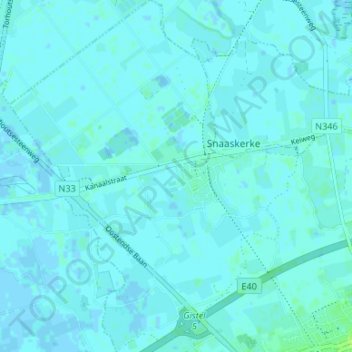
Name: Snaaskerke topographic map, elevation, terrain.
Location: Snaaskerke, Gistel, Oostende, West-Vlaanderen, België (51.15544 2.90180 51.19715 2.95655)
Average elevation: 7 ft
Minimum elevation: -7 ft
Maximum elevation: 33 ft
Make a donation
Gear up for your next adventure:
As an Amazon Associate, this site earns from qualifying purchases at no extra cost to you.
Other topographic maps
Click on a map to view its topography, its elevation and its terrain.
Make a donation
Gear up for your next adventure:
As an Amazon Associate, this site earns from qualifying purchases at no extra cost to you.
Make a donation
Gear up for your next adventure:
As an Amazon Associate, this site earns from qualifying purchases at no extra cost to you.
Make a donation
Gear up for your next adventure:
As an Amazon Associate, this site earns from qualifying purchases at no extra cost to you.
De Meiboom
België > West-Vlaanderen > Oostende > Oudenburg > Roksem > De Meiboom
Average elevation: 20 ft