Geolocate

Cater topographic map

Click on the map to display elevation.

About this map

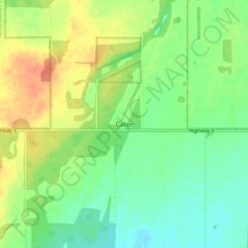
Name: Cater topographic map, elevation, terrain.

Location: Cater, Medstead No. 497, Saskatchewan, Canada (53.34667 -108.07000 53.38667 -108.03000)

Average elevation: 2,362 ft

Minimum elevation: 2,303 ft

Maximum elevation: 2,448 ft

Gear up for your next adventure:

🪶Paracord Bracelet - Survival bracelet with built‑in tools
📚USA Hiking Guide Books - Top trail guides and map books
🥩Freeze-Dried Meals - Nutritious and lightweight food for remote expeditions
🔥Plasma Lighters - Windproof lighters that work in any weather condition
🧷Carabiner Set - Durable clips for gear attachment

As an Amazon Associate, this site earns from qualifying purchases at no extra cost to you.