
Riner topographic map
Click on the map to display elevation.
About this map
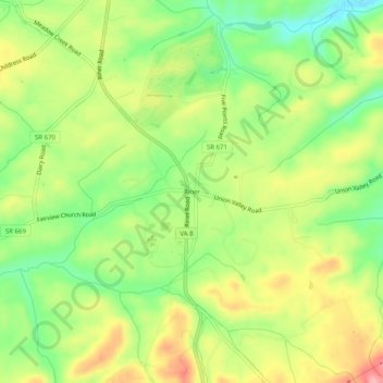
Name: Riner topographic map, elevation, terrain.
Location: Riner, Montgomery County, Virginia, United States (37.04652 -80.46061 37.08652 -80.42061)
Average elevation: 2,064 ft
Minimum elevation: 1,870 ft
Maximum elevation: 2,287 ft
Montgomery County trails, hiking, mountain biking, running and outdoor activities
Other topographic maps
Click on a map to view its topography, its elevation and its terrain.