
Make a donation
Gear up for your next adventure:
As an Amazon Associate, this site earns from qualifying purchases at no extra cost to you.
Koksijde topographic map
Click on the map to display elevation.
Make a donation
Gear up for your next adventure:
As an Amazon Associate, this site earns from qualifying purchases at no extra cost to you.
About this map
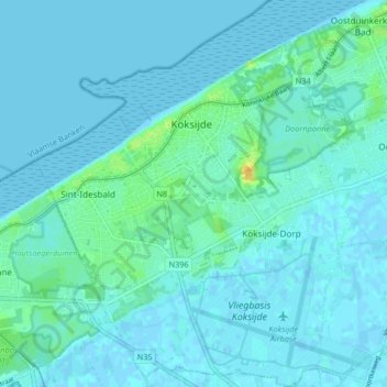
Name: Koksijde topographic map, elevation, terrain.
Location: Koksijde, Veurne, West-Vlaanderen, Vlaanderen, 8670, België (51.08351 2.60178 51.13500 2.66917)
Average elevation: 13 ft
Minimum elevation: -7 ft
Maximum elevation: 89 ft
Make a donation
Gear up for your next adventure:
As an Amazon Associate, this site earns from qualifying purchases at no extra cost to you.
Other topographic maps
Click on a map to view its topography, its elevation and its terrain.
Hoge Blekker
België > West-Vlaanderen > Veurne > Koksijde > Koksijde-Dorp
Dit zogenaamd rijshout bestond oorspronkelijk uit gekapte duindoorn, later werd vooral snoeihout van de cultuurpopulier gebruikt. De tussenliggende zones werden bepoot met helmgras. Deze grassoort bezit het vermogen om bij overstuiving via verticale uitlopers van zijn wortels boven op het nieuw aangevoerde…
Average elevation: 20 ft
Oostduinkerke-Bad
België > West-Vlaanderen > Veurne > Koksijde > Oostduinkerke
Average elevation: 13 ft
Make a donation
Gear up for your next adventure:
As an Amazon Associate, this site earns from qualifying purchases at no extra cost to you.