Geolocate

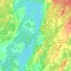
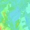
Shadow Lake topographic map

Click on the map to display elevation.

About this map
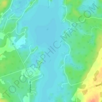
Name: Shadow Lake topographic map, elevation, terrain.

Location: Shadow Lake, Kawartha Lakes, Central Ontario, Ontario, K0M 2L0, Canada (44.72223 -78.79174 44.72233 -78.79164)

Average elevation: 873 ft

Minimum elevation: 837 ft

Maximum elevation: 978 ft

Other topographic maps

Click on a map to view its topography, its elevation and its terrain.
Pigeon River

Canada > Ontario > Kawartha Lakes > Omemee

Average elevation: 850 ft

Dalrymple Lake

Canada > Ontario > Kawartha Lakes

Average elevation: 791 ft

Head Lake

Canada > Ontario > Kawartha Lakes

Average elevation: 912 ft

Sturgeon Lake

Canada > Ontario > Kawartha Lakes

Average elevation: 873 ft

Emily Provincial Park

Canada > Ontario > Kawartha Lakes

Average elevation: 850 ft

Young Lake

Canada > Ontario > Kawartha Lakes

Average elevation: 758 ft

Four Mile Lake

Canada > Ontario > Kawartha Lakes

Average elevation: 925 ft

Cameron Lake

Canada > Ontario > Kawartha Lakes > Fenelon Falls

Average elevation: 860 ft

Victoria Lake

Canada > Ontario > Kawartha Lakes

Average elevation: 1,010 ft

Gear up for your next adventure:

🦟Ultrasonic Repellers - Create a bug-free zone at your camp or rest stop
🛡️Insect Repellent - Protection against bugs during outdoor activities
😴Insulated Sleeping Pads - Compact and warm pads for high-elevation camping
🪑Portable Camp Table - Compact table for campsite meals
🎒Day Hiking Backpack - Lightweight backpack perfect for day trips and outdoor adventures

As an Amazon Associate, this site earns from qualifying purchases at no extra cost to you.