Geolocate

Jerusalem topographic map

Click on the map to display elevation.

About this map

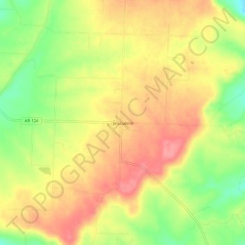
Name: Jerusalem topographic map, elevation, terrain.

Location: Jerusalem, Conway County, Arkansas, 72080, United States (35.38480 -92.83683 35.42480 -92.79683)

Average elevation: 725 ft

Minimum elevation: 558 ft

Maximum elevation: 846 ft

Conway County trails, hiking, mountain biking, running and outdoor activities

Other topographic maps

Click on a map to view its topography, its elevation and its terrain.

Menifee

United States > Arkansas > Conway County

Average elevation: 318 ft

Oppelo

United States > Arkansas > Conway County

Average elevation: 318 ft

Plumerville

United States > Arkansas > Conway County

Average elevation: 348 ft

Morrilton

United States > Arkansas > Conway County

Average elevation: 338 ft

Gear up for your next adventure:

☀️Outdoor Sunscreen - High protection sunscreen for outdoor activities
🪶LED Camping Lantern - Bright lantern for camp lighting
🔌Solar Panel Charger - Charge gear sustainably outdoors
🪄Magnetic Compass - Accurate compass for navigation
🎒Gear Packing Cubes - Organize your backpack efficiently

As an Amazon Associate, this site earns from qualifying purchases at no extra cost to you.