
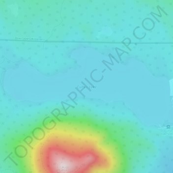
Cultus Lake topographic map
Interactive map
Click on the map to display elevation.
About this map
Name: Cultus Lake topographic map, elevation, terrain.
Average elevation: 4,957 ft
Minimum elevation: 4,610 ft
Maximum elevation: 6,683 ft
Other topographic maps
Click on a map to view its topography, its elevation and its terrain.
Parkdale
United States of America > Oregon > Parkdale
Parkdale, Hood River County, Oregon, 97041, United States of America
Average elevation: 1,772 ft
Firwood
United States of America > Oregon > Firwood
Firwood, Clackamas County, Oregon, United States of America
Average elevation: 1,243 ft
Dutch Point
United States of America > Oregon
Dutch Point, Brown Road, Wallowa County, Oregon, United States of America
Average elevation: 3,251 ft
Grebe Creek
United States of America > Oregon
Grebe Creek, Washington County, Oregon, United States of America
Average elevation: 860 ft
Serviceberry Creek
United States of America > Oregon
Serviceberry Creek, Douglas County, Oregon, United States of America
Average elevation: 3,340 ft
Grizzly
United States of America > Oregon > Grizzly
Grizzly, Jefferson County, Oregon, United States of America
Average elevation: 3,763 ft
Gibbon
United States of America > Oregon > Gibbon
Gibbon, Umatilla County, Oregon, United States of America
Average elevation: 2,241 ft
The Villages at Mount Hood
United States of America > Oregon > The Villages at Mount Hood
The Villages at Mount Hood, Clackamas County, Oregon, United States of America
Average elevation: 2,615 ft
Deadwood
United States of America > Oregon > Deadwood
Deadwood, Lane County, Oregon, United States of America
Average elevation: 696 ft
Astoria
United States of America > Oregon > Astoria
Astoria, Clatsop County, Oregon, 97103, United States of America
Average elevation: 49 ft
Middle Fork Beaver Creek
United States of America > Oregon > Portland
Middle Fork Beaver Creek, Portland, Multnomah County, Oregon, 97009, United States of America
Average elevation: 584 ft
Cascade Range
United States of America > Oregon
Cascade Range, Lane County, Oregon, United States of America
Average elevation: 5,571 ft
God's Thumb
United States of America > Oregon
God's Thumb, Lincoln County, Oregon, 97364, United States of America
Average elevation: 95 ft
Cathedral Park
United States of America > Oregon > Portland
Cathedral Park, Portland, Multnomah County, Oregon, United States of America
Average elevation: 151 ft
Irrigon
United States of America > Oregon > Irrigon
Irrigon, Morrow County, Oregon, United States of America
Average elevation: 299 ft