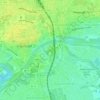
Etting topographic map
Click on the map to display elevation.
Etting
Etting ist ein Stadtteil von Ingolstadt in Oberbayern und liegt im Norden des Stadtgebiets auf einer Höhe von etwa 350 m ü. NN. Bei 4950 Einwohnern (Stand 31. Dezember 2021) und einer Fläche von 8,61 km² hat Etting eine Bevölkerungsdichte von 563 Einwohnern je km².
About this map

Name: Etting topographic map, elevation, terrain.
Location: Etting, Ingolstadt, Bayern, Deutschland (48.78476 11.38246 48.82289 11.43159)
Average elevation: 1,263 ft
Minimum elevation: 1,214 ft
Maximum elevation: 1,385 ft
Other topographic maps
Click on a map to view its topography, its elevation and its terrain.