
Make a donation
Gear up for your next adventure:
As an Amazon Associate, this site earns from qualifying purchases at no extra cost to you.
Zuchering topographic map
Click on the map to display elevation.
Make a donation
Gear up for your next adventure:
As an Amazon Associate, this site earns from qualifying purchases at no extra cost to you.
About this map
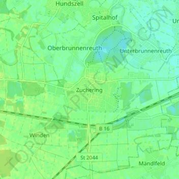
Name: Zuchering topographic map, elevation, terrain.
Location: Zuchering, Ingolstadt, Bayern, 85051, Deutschland (48.69174 11.38599 48.73174 11.42599)
Average elevation: 1,214 ft
Minimum elevation: 1,194 ft
Maximum elevation: 1,230 ft
Make a donation
Gear up for your next adventure:
As an Amazon Associate, this site earns from qualifying purchases at no extra cost to you.
Other topographic maps
Click on a map to view its topography, its elevation and its terrain.
Etting
Deutschland > Bayern > Ingolstadt
Etting ist ein Stadtteil von Ingolstadt in Oberbayern und liegt im Norden des Stadtgebiets auf einer Höhe von etwa 350 m ü. NN. Bei 4950 Einwohnern (Stand 31. Dezember 2021) und einer Fläche von 8,61 km² hat Etting eine Bevölkerungsdichte von 563 Einwohnern je km².
Average elevation: 1,263 ft
Make a donation
Gear up for your next adventure:
As an Amazon Associate, this site earns from qualifying purchases at no extra cost to you.
Gerolfing Nord
Deutschland > Bayern > Ingolstadt
Das Pfarrdorf liegt auf einer Höhe von 374 m ü. NN. Im Süden des Ortes befindet sich der Eichenwald mit dem Gerolfinger Weiher (Schafirrsee). Etwa 2 Kilometer vom südlichen Ortsrand entfernt fließt die Donau in östlicher Richtung.
Average elevation: 1,227 ft
Make a donation
Gear up for your next adventure:
As an Amazon Associate, this site earns from qualifying purchases at no extra cost to you.
Make a donation
Gear up for your next adventure:
As an Amazon Associate, this site earns from qualifying purchases at no extra cost to you.