
Queets topographic map
Click on the map to display elevation.
About this map
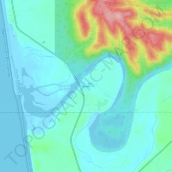
Name: Queets topographic map, elevation, terrain.
Location: Queets, Jefferson County, Washington, United States (47.51988 -124.35237 47.55988 -124.31237)
Average elevation: 118 ft
Minimum elevation: -16 ft
Maximum elevation: 548 ft
Jefferson County trails, hiking, mountain biking, running and outdoor activities
Other topographic maps
Click on a map to view its topography, its elevation and its terrain.
Admiralty Inlet
United States > Washington > Jefferson County > Port Townsend
Average elevation: 112 ft