
Thank you for supporting this site ❤️
Make a donation
Make a donation
Gear up for your next adventure:
As an Amazon Associate, this site earns from qualifying purchases at no extra cost to you.
Tignère topographic map
Click on the map to display elevation.
Thank you for supporting this site ❤️
Make a donation
Make a donation
Gear up for your next adventure:
As an Amazon Associate, this site earns from qualifying purchases at no extra cost to you.
About this map
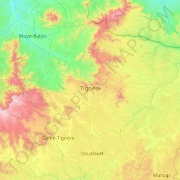
Name: Tignère topographic map, elevation, terrain.
Location: Tignère, Faro-et-Déo, Adamawa, Cameroon (6.96734 12.24170 7.75510 13.24641)
Average elevation: 3,261 ft
Minimum elevation: 1,394 ft
Maximum elevation: 7,808 ft
Thank you for supporting this site ❤️
Make a donation
Make a donation
Gear up for your next adventure:
As an Amazon Associate, this site earns from qualifying purchases at no extra cost to you.