
Mount Redoubt topographic map
Click on the map to display elevation.
About this map
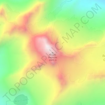
Name: Mount Redoubt topographic map, elevation, terrain.
Location: Mount Redoubt, Whatcom County, Washington, United States (48.95676 -121.29947 48.95686 -121.29937)
Average elevation: 6,827 ft
Minimum elevation: 4,934 ft
Maximum elevation: 8,891 ft
Whatcom County trails, hiking, mountain biking, running and outdoor activities
Other topographic maps
Click on a map to view its topography, its elevation and its terrain.
Ross Lake
United States > Washington > Whatcom County
Ross Lake is a large reservoir in the North Cascade mountains of northern Washington state, United States, and southwestern British Columbia, Canada. The lake runs approximately north–south, is 23 miles (37 km) long, up to 1.5 miles (2.5 km) wide, and the full reservoir elevation is 1,604 feet above sea…
Average elevation: 4,311 ft