Geolocate

Iuka topographic map

Click on the map to display elevation.

About this map

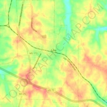
Name: Iuka topographic map, elevation, terrain.

Location: Iuka, Tishomingo County, Mississippi, United States (34.77805 -88.23769 34.84155 -88.17191)

Average elevation: 584 ft

Minimum elevation: 463 ft

Maximum elevation: 686 ft

Tishomingo County trails, hiking, mountain biking, running and outdoor activities

Other topographic maps

Click on a map to view its topography, its elevation and its terrain.

Short

United States > Mississippi > Tishomingo County

Average elevation: 548 ft

Gear up for your next adventure:

🛠️Outdoor Gear Repair Kit - Essential tools to fix gear on the trail
🦟Ultrasonic Repellers - Create a bug-free zone at your camp or rest stop
🪑Ultralight Camp Chairs - Portable seating for resting after a long day of mapping
🧴Hand Sanitizer - Keep hands clean while hiking
Backpacking Tent - Lightweight and durable tent for multi‑day hikes

As an Amazon Associate, this site earns from qualifying purchases at no extra cost to you.