
Bare Butte topographic map
Click on the map to display elevation.
About this map
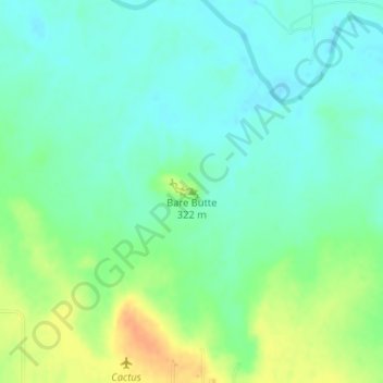
Name: Bare Butte topographic map, elevation, terrain.
Location: Bare Butte, Wichita County, Texas, United States (33.88505 -98.64039 33.88515 -98.64029)
Average elevation: 997 ft
Minimum elevation: 955 ft
Maximum elevation: 1,079 ft
Wichita County trails, hiking, mountain biking, running and outdoor activities
Other topographic maps
Click on a map to view its topography, its elevation and its terrain.
Cashion Community
United States > Texas > Wichita County
Cashion Community is located eight miles north of Wichita Falls off State Highway 240 in northeastern Wichita County. Its elevation is 994 feet above mean sea level. The city has a total area of 1.9 square miles (4.9 km2), all land.
Average elevation: 1,017 ft