
Hinterstein topographic map
Click on the map to display elevation.
About this map
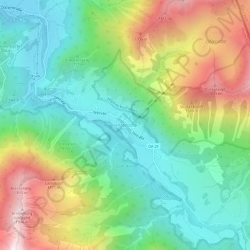
Name: Hinterstein topographic map, elevation, terrain.
Average elevation: 3,967 ft
Minimum elevation: 2,631 ft
Maximum elevation: 6,411 ft
Other topographic maps
Click on a map to view its topography, its elevation and its terrain.
Ostrach
Deutschland > Bayern > Landkreis Oberallgäu > Bad Hindelang
Liste der direkten Zuflüsse der Ostrach und ihrer beiden Oberläufe, jeweils von der Quelle bis zur Mündung. Mit Gewässerlänge, Einzugsgebiet und Höhe. Andere Quellen für die Angaben sind vermerkt.
Average elevation: 4,439 ft
Hintersteiner Tal
Deutschland > Bayern > Landkreis Oberallgäu > Bad Hindelang
Average elevation: 4,593 ft