
共和镇 topographic map
Interactive map
Click on the map to display elevation.
About this map
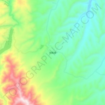
Name: 共和镇 topographic map, elevation, terrain.
Location: 共和镇, 湟中区, 西宁市, 青海省, 中国 (36.55617 101.36348 36.63617 101.44348)
Average elevation: 9,009 ft
Minimum elevation: 8,077 ft
Maximum elevation: 11,089 ft
Other topographic maps
Click on a map to view its topography, its elevation and its terrain.