
汉东回族乡 topographic map
Interactive map
Click on the map to display elevation.
About this map
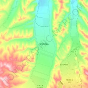
Name: 汉东回族乡 topographic map, elevation, terrain.
Location: 汉东回族乡, 湟中区, 西宁市, 青海省, 中国 (36.52476 101.45142 36.60476 101.53142)
Average elevation: 8,491 ft
Minimum elevation: 8,005 ft
Maximum elevation: 9,180 ft
Other topographic maps
Click on a map to view its topography, its elevation and its terrain.