Geolocate

Drain topographic map

Click on the map to display elevation.

About this map

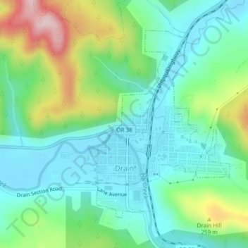
Name: Drain topographic map, elevation, terrain.

Location: Drain, Douglas County, Oregon, United States (43.65334 -123.32294 43.67376 -123.30281)

Average elevation: 528 ft

Minimum elevation: 269 ft

Maximum elevation: 1,171 ft

Douglas County trails, hiking, mountain biking, running and outdoor activities

Other topographic maps

Click on a map to view its topography, its elevation and its terrain.

Scottsburg

United States > Oregon > Douglas County

Average elevation: 551 ft

Tenmile

United States > Oregon > Douglas County

Average elevation: 915 ft

Umpqua

United States > Oregon > Douglas County

Average elevation: 449 ft

Diamond Lake

United States > Oregon > Douglas County

Average elevation: 5,354 ft

Dillard

United States > Oregon > Douglas County

Average elevation: 663 ft

Rice Hill

United States > Oregon > Douglas County

Average elevation: 791 ft

Glide

United States > Oregon > Douglas County

Average elevation: 850 ft

Azalea

United States > Oregon > Douglas County

Average elevation: 1,982 ft

Toketee Falls

United States > Oregon > Douglas County

Average elevation: 2,838 ft

Tyee

United States > Oregon > Douglas County

Average elevation: 712 ft

Wits End

United States > Oregon > Douglas County

Average elevation: 6,332 ft

Azalea

United States > Oregon > Douglas County

Average elevation: 1,982 ft

Gear up for your next adventure:

🔥Fast-Boil Camping Stoves - Efficient cooking systems for quick trail meals
🪑Ultralight Camp Chairs - Portable seating for resting after a long day of mapping
📶Satellite Messenger - Communication device off‑grid
🧯Portable Fire Pit - Compact fire pit for camping spots
🔌USB Car Charger - Car charger for on‑the‑go power needs

As an Amazon Associate, this site earns from qualifying purchases at no extra cost to you.