Altona topographic map
Interactive map
Click on the map to display elevation.
About this map
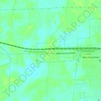
Name: Altona topographic map, elevation, terrain.
Location: Altona, DeKalb County, Indiana, United States (41.34905 -85.15980 41.35527 -85.14532)
Average elevation: 889 ft
Minimum elevation: 869 ft
Maximum elevation: 906 ft
Other topographic maps
Click on a map to view its topography, its elevation and its terrain.
Spencerville
United States > Indiana > DeKalb County
Spencerville, DeKalb County, Indiana, 46788, United States
Average elevation: 817 ft
Corunna
United States > Indiana > DeKalb County
Corunna, DeKalb County, Indiana, United States
Average elevation: 968 ft
Ashley
United States > Indiana > DeKalb County
Ashley, DeKalb County, Indiana, 46705, United States
Average elevation: 994 ft
Butler
United States > Indiana > DeKalb County
Butler, DeKalb County, Indiana, United States
Average elevation: 869 ft
St. Joe
United States > Indiana > DeKalb County
St. Joe, DeKalb County, Indiana, United States
Average elevation: 820 ft
Waterloo
United States > Indiana > DeKalb County
Waterloo, DeKalb County, Indiana, United States
Average elevation: 906 ft
Stafford Center
United States > Indiana > DeKalb County
Stafford Center, DeKalb County, Indiana, 46721, United States
Average elevation: 846 ft
Garrett
United States > Indiana > DeKalb County
Garrett, DeKalb County, Indiana, 46738, United States
Average elevation: 886 ft