Geolocate

Rice topographic map

Click on the map to display elevation.

About this map

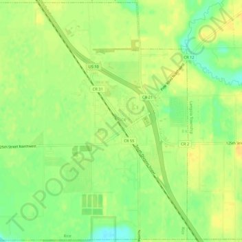
Name: Rice topographic map, elevation, terrain.

Location: Rice, Benton County, Minnesota, United States (45.73522 -94.25900 45.77158 -94.20597)

Average elevation: 1,066 ft

Minimum elevation: 1,014 ft

Maximum elevation: 1,096 ft

Benton County trails, hiking, mountain biking, running and outdoor activities

Other topographic maps

Click on a map to view its topography, its elevation and its terrain.

Oak Park

United States > Minnesota > Benton County

Average elevation: 1,122 ft

Watab

United States > Minnesota > Benton County

Average elevation: 1,053 ft

Gear up for your next adventure:

🛠️Outdoor Gear Repair Kit - Essential tools to fix gear on the trail
🔭Compact Binoculars - HD vision for scouting terrain and identifying distant landmarks
🕶️GPS Smartphone Mount - Secure mount for phone navigation
🔥Plasma Lighters - Windproof lighters that work in any weather condition
🔭Stargazing Telescopes - Perfect for camping in low-light pollution areas shown on maps

As an Amazon Associate, this site earns from qualifying purchases at no extra cost to you.