Geolocate

Tabor topographic map

Click on the map to display elevation.

About this map

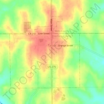
Name: Tabor topographic map, elevation, terrain.

Location: Tabor, Fremont County, Iowa, 51653, United States (40.88724 -95.68586 40.90595 -95.66173)

Average elevation: 1,191 ft

Minimum elevation: 1,093 ft

Maximum elevation: 1,266 ft

Fremont County trails, hiking, mountain biking, running and outdoor activities

Other topographic maps

Click on a map to view its topography, its elevation and its terrain.

Bartlett

United States > Iowa > Fremont County

Average elevation: 945 ft

Percival

United States > Iowa > Fremont County

Average elevation: 928 ft

McPaul

United States > Iowa > Fremont County

Average elevation: 935 ft

Anderson

United States > Iowa > Fremont County

Average elevation: 991 ft

Gear up for your next adventure:

📦Gear Storage Bags - Organize and protect outdoor equipment
🗻Climbing Gear Basics - Essential gear for beginner climbers
🚪Portable Camp Chair - Foldable chair for comfort at camp
🧣Hiking Neck Gaiter - Multi‑use neck protection for outdoor weather
📶Satellite Messenger - Communication device off‑grid

As an Amazon Associate, this site earns from qualifying purchases at no extra cost to you.