Geolocate

Zuidland topographic map

Click on the map to display elevation.

About this map

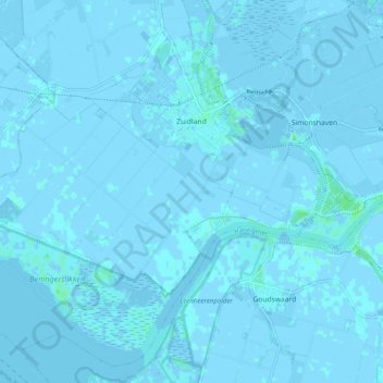
Name: Zuidland topographic map, elevation, terrain.

Location: Zuidland, Nissewaard, South Holland, Netherlands (51.78277 4.19263 51.83880 4.29186)

Average elevation: 0 ft

Minimum elevation: -16 ft

Maximum elevation: 26 ft

Other topographic maps

Click on a map to view its topography, its elevation and its terrain.

Botlek

Netherlands > South Holland

Average elevation: 10 ft

Langeraar

Netherlands > South Holland

Average elevation: -10 ft

Meije

Netherlands > South Holland > Nieuwkoop

Average elevation: -7 ft

Weerestein

Netherlands > South Holland > Hillegom

Average elevation: 0 ft

Broekhuizen

Netherlands > South Holland > Gouda

Average elevation: -3 ft

Ankerpark

Netherlands > South Holland > Leiden

Average elevation: 10 ft

Middelsluis

Netherlands > South Holland > Numansdorp

Average elevation: 0 ft

Weerestein

Netherlands > South Holland > Hillegom

Average elevation: 0 ft

Meijendel

Netherlands > South Holland > Wassenaar

Average elevation: 20 ft

Coepelduynen

Netherlands > South Holland > Katwijk

Average elevation: 13 ft

Het Park

Netherlands > South Holland > Rotterdam

Average elevation: 13 ft

Waalhaven

Netherlands > South Holland > Rotterdam

Average elevation: 10 ft

Gear up for your next adventure:

🧦Merino Wool Socks - Moisture-wicking, blister-preventing socks for long treks
🌎3D Topographic Globes - Raised relief globes for a tactile understanding of geography
🧭Orienteering Set - Complete compass and map reading kit
🛶Inflatable Kayak - Portable kayak for rivers, lakes, and expeditions
🧭Map Reading Tools - Tools and kits for map navigation

As an Amazon Associate, this site earns from qualifying purchases at no extra cost to you.