
Thank you for supporting this site ❤️
Make a donation
Make a donation
Gear up for your next adventure:
As an Amazon Associate, this site earns from qualifying purchases at no extra cost to you.
Mvoula topographic map
Click on the map to display elevation.
Thank you for supporting this site ❤️
Make a donation
Make a donation
Gear up for your next adventure:
As an Amazon Associate, this site earns from qualifying purchases at no extra cost to you.
About this map
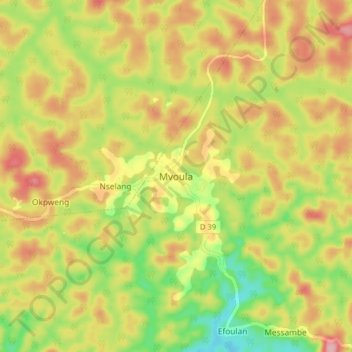
Name: Mvoula topographic map, elevation, terrain.
Location: Mvoula, Biwong-Bulu, Mvila, South, Cameroon (2.81093 11.54893 2.89093 11.62893)
Average elevation: 2,251 ft
Minimum elevation: 1,988 ft
Maximum elevation: 2,497 ft
Thank you for supporting this site ❤️
Make a donation
Make a donation
Gear up for your next adventure:
As an Amazon Associate, this site earns from qualifying purchases at no extra cost to you.