
Thank you for supporting this site ❤️
Make a donation
Make a donation
Gear up for your next adventure:
As an Amazon Associate, this site earns from qualifying purchases at no extra cost to you.
Krapje topographic map
Click on the map to display elevation.
Thank you for supporting this site ❤️
Make a donation
Make a donation
Gear up for your next adventure:
As an Amazon Associate, this site earns from qualifying purchases at no extra cost to you.
About this map
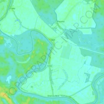
Name: Krapje topographic map, elevation, terrain.
Location: Krapje, Općina Jasenovac, Sisak-Moslavina County, Croatia (45.26996 16.79673 45.31842 16.88908)
Average elevation: 308 ft
Minimum elevation: 292 ft
Maximum elevation: 348 ft
Thank you for supporting this site ❤️
Make a donation
Make a donation
Gear up for your next adventure:
As an Amazon Associate, this site earns from qualifying purchases at no extra cost to you.