
Kyle topographic map
Click on the map to display elevation.
About this map
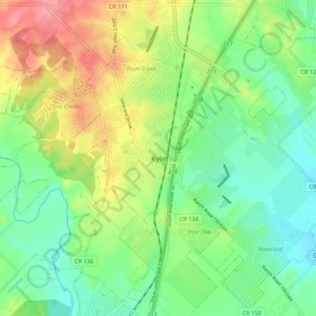
Name: Kyle topographic map, elevation, terrain.
Location: Kyle, Hays County, Texas, 78640, United States (29.94929 -97.91721 30.02929 -97.83721)
Average elevation: 709 ft
Minimum elevation: 597 ft
Maximum elevation: 896 ft
Hays County trails, hiking, mountain biking, running and outdoor activities
Other topographic maps
Click on a map to view its topography, its elevation and its terrain.