Geolocate

Yangoru topographic map

Click on the map to display elevation.

About this map

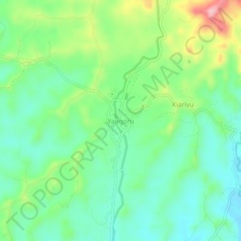
Name: Yangoru topographic map, elevation, terrain.

Location: Yangoru, East Sepik, Momase Region, Papua New Guinea (-3.67472 143.27579 -3.63472 143.31579)

Average elevation: 748 ft

Minimum elevation: 551 ft

Maximum elevation: 1,178 ft

Other topographic maps

Click on a map to view its topography, its elevation and its terrain.

Angoram District

Papua New Guinea > East Sepik

Average elevation: 1,293 ft

xxx

Papua New Guinea > East Sepik

Average elevation: 112 ft

Frieda River

Papua New Guinea > East Sepik

Average elevation: 581 ft

Gear up for your next adventure:

🛠️Outdoor Gear Repair Kit - Essential tools to fix gear on the trail
🪵Folding Camp Saw - Compact saw for wood and campsite work
🧭Outdoor Navigation Book - Learn advanced navigation skills
🎒Trekking Poles - Sturdy poles for balance and stability on rough terrain
🪶Trail Camera - Capture wildlife on your hikes

As an Amazon Associate, this site earns from qualifying purchases at no extra cost to you.