Geolocate

Rayle topographic map

Click on the map to display elevation.

About this map

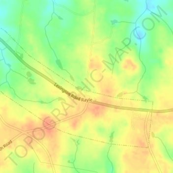
Name: Rayle topographic map, elevation, terrain.

Location: Rayle, Wilkes County, Georgia, 30660, United States (33.78227 -82.92004 33.80157 -82.88733)

Average elevation: 643 ft

Minimum elevation: 561 ft

Maximum elevation: 702 ft

Wilkes County trails, hiking, mountain biking, running and outdoor activities

Other topographic maps

Click on a map to view its topography, its elevation and its terrain.

Tignall

United States > Georgia > Wilkes County

Average elevation: 591 ft

Adasburg

United States > Georgia > Wilkes County

Average elevation: 476 ft

Gear up for your next adventure:

🪶Survival Guide Book - Expert advice for emergency preparedness
🏔️Mountain Trail Maps - High‑detail maps for popular peaks
🕶️Glacier Sunglasses - Side shields to protect eyes from high-altitude snow glare
📻Weather Alert Radios - Stay informed of storm risks while off-the-grid
🌧️Backpack Rain Cover - Keep gear dry in wet weather

As an Amazon Associate, this site earns from qualifying purchases at no extra cost to you.