
马尔康镇 topographic map
Interactive map
Click on the map to display elevation.
About this map
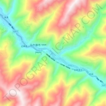
Name: 马尔康镇 topographic map, elevation, terrain.
Location: 马尔康镇, 马尔康市, 阿坝藏族羌族自治州, 四川省, 中国 (31.86432 102.17770 31.94432 102.25770)
Average elevation: 10,531 ft
Minimum elevation: 8,432 ft
Maximum elevation: 13,100 ft
Other topographic maps
Click on a map to view its topography, its elevation and its terrain.