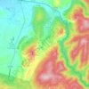
Monarch Lake topographic map
Click on the map to display elevation.
About this map

Name: Monarch Lake topographic map, elevation, terrain.
Location: Monarch Lake, Grand County, Colorado, United States (40.10114 -105.74943 40.11067 -105.73433)
Average elevation: 8,953 ft
Minimum elevation: 8,287 ft
Maximum elevation: 10,522 ft
Grand County trails, hiking, mountain biking, running and outdoor activities
Other topographic maps
Click on a map to view its topography, its elevation and its terrain.
Fraser
United States > Colorado > Grand County
Fraser is located in southeastern Grand County at 39°56′39″N 105°48′48″W / 39.94417°N 105.81333°W / 39.94417; -105.81333 (39.944158, -105.813355), at an elevation of 8,574 feet (2,613 m) above sea level. It is bordered to the south by the town of Winter Park and to the north by…
Average elevation: 8,845 ft
Tabernash
United States > Colorado > Grand County
On August 10, 1984, a Cessna L-19 Bird Dog (registration N4584A), piloted by James Jeb Caddell, 36, crashed in a forest near Tabernash. The aircraft was en route from Granby to Jeffco Airport, Colorado. The wreckage was found by backpackers three years later on August 23, 1987. A 6½ minute video shot from a…
Average elevation: 8,504 ft
Rabbit Ears Pass
United States > Colorado > Grand County
Although lower in elevation than many of the high mountain passes farther to the south in the Colorado Rockies, Rabbit Ears Pass often receives a great deal of snow in winter and is subject to regular short closures during heavy winter storms. The seasonal snowpack on this pass is a major source of water for…
Average elevation: 9,357 ft
Radium
United States > Colorado > Grand County
Radium, elevation 6,890 feet (2,100 m), is a small rural unincorporated community in southwestern Grand County, Colorado, United States. The community sits in the mountains along an isolated stretch of Colorado River downstream from Gore Canyon and southwest of Kremmling. The mainline of the Denver and Rio…
Average elevation: 7,418 ft