Geolocate

Swan River topographic map

Click on the map to display elevation.

About this map

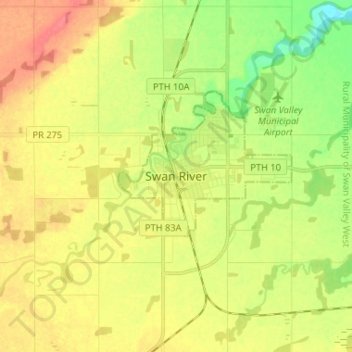
Name: Swan River topographic map, elevation, terrain.

Location: Swan River, Manitoba, R0I 1Z0, Canada (52.06506 -101.31054 52.14506 -101.23054)

Average elevation: 1,119 ft

Minimum elevation: 1,024 ft

Maximum elevation: 1,207 ft

Gear up for your next adventure:

🪶Trail Camera - Capture wildlife on your hikes
🏫Relief Map Kits - Hands-on tools for teaching landforms and elevation
🔭Compact Binoculars - HD vision for scouting terrain and identifying distant landmarks
🌐World Map Poster - Decorative world maps with topographic info
🥾Men's Hiking Boots - Durable, waterproof footwear for rugged terrain and steep inclines

As an Amazon Associate, this site earns from qualifying purchases at no extra cost to you.