
Make a donation
Gear up for your next adventure:
As an Amazon Associate, this site earns from qualifying purchases at no extra cost to you.
Dyatlov Pass topographic map
Click on the map to display elevation.
Make a donation
Gear up for your next adventure:
As an Amazon Associate, this site earns from qualifying purchases at no extra cost to you.
Dyatlov Pass
Diaries and cameras found around their last campsite made it possible to track the group's route up to the day preceding the incident. On 31 January, the group arrived at the edge of a highland area and began to prepare for climbing. In a wooded valley, they cached surplus food and equipment that would be used for the trip back. The next day, the hikers started to move through the pass. It seems they planned to get over the pass and make camp for the next night on the opposite side, but because of worsening weather conditions—snowstorms and decreasing visibility—they lost their direction and deviated west, toward the top of Kholat Syakhl. When they realised their mistake, the group decided to set up camp there on the slope of the mountain, rather than move 1.5 kilometres (0.93 mi) downhill to a forested area that would have offered some shelter from the weather. Yudin speculated, "Dyatlov probably did not want to lose the altitude they had gained, or he decided to practice camping on the mountain slope."
Make a donation
Gear up for your next adventure:
As an Amazon Associate, this site earns from qualifying purchases at no extra cost to you.
About this map
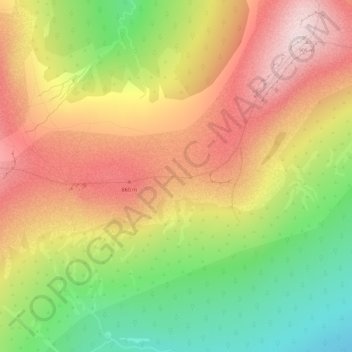
Name: Dyatlov Pass topographic map, elevation, terrain.
Average elevation: 2,320 ft
Minimum elevation: 1,621 ft
Maximum elevation: 2,949 ft
Make a donation
Gear up for your next adventure:
As an Amazon Associate, this site earns from qualifying purchases at no extra cost to you.