
永固镇 topographic map
Interactive map
Click on the map to display elevation.
About this map
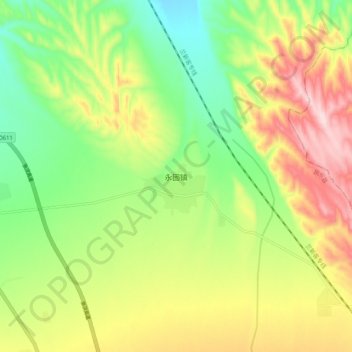
Name: 永固镇 topographic map, elevation, terrain.
Location: 永固镇, 民乐县, 张掖市, 甘肃省, 734500, 中国 (38.33017 100.88750 38.41017 100.96750)
Average elevation: 8,225 ft
Minimum elevation: 7,802 ft
Maximum elevation: 8,780 ft
Other topographic maps
Click on a map to view its topography, its elevation and its terrain.