
民乐县 topographic map
Interactive map
Click on the map to display elevation.
About this map
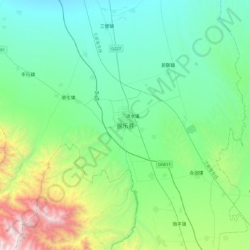
Name: 民乐县 topographic map, elevation, terrain.
Location: 民乐县, 张掖市, 甘肃省, 734500, 中国 (38.27040 100.65144 38.59040 100.97144)
Average elevation: 8,150 ft
Minimum elevation: 6,348 ft
Maximum elevation: 14,810 ft
Other topographic maps
Click on a map to view its topography, its elevation and its terrain.