
Thank you for supporting this site ❤️
Make a donation
Make a donation
Gear up for your next adventure:
As an Amazon Associate, this site earns from qualifying purchases at no extra cost to you.
Bryncrug topographic map
Click on the map to display elevation.
Thank you for supporting this site ❤️
Make a donation
Make a donation
Gear up for your next adventure:
As an Amazon Associate, this site earns from qualifying purchases at no extra cost to you.
About this map
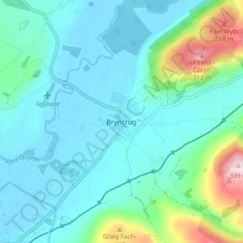
Name: Bryncrug topographic map, elevation, terrain.
Location: Bryncrug, Gwynedd, Wales, LL36 9PB, United Kingdom (52.58800 -4.07500 52.62800 -4.03500)
Average elevation: 200 ft
Minimum elevation: -7 ft
Maximum elevation: 1,106 ft
Thank you for supporting this site ❤️
Make a donation
Make a donation
Gear up for your next adventure:
As an Amazon Associate, this site earns from qualifying purchases at no extra cost to you.
Other topographic maps
Click on a map to view its topography, its elevation and its terrain.