Geolocate

Llyn Cau topographic map

Click on the map to display elevation.

About this map

Name: Llyn Cau topographic map, elevation, terrain.

Location: Llyn Cau, Llanfihangel-y-Pennant, Gwynedd, Wales, United Kingdom (52.69195 -3.90656 52.69510 -3.89859)

Average elevation: 1,821 ft

Minimum elevation: 279 ft

Maximum elevation: 2,881 ft

Other topographic maps

Click on a map to view its topography, its elevation and its terrain.
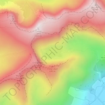
Cwm Idwal

United Kingdom > Wales > Gwynedd

Cwm Idwal is a cirque (or corrie) in the Glyderau range of mountains in northern Snowdonia, the national park in the mountainous region of North Wales. Its main interest is to hill walkers and rock climbers, but it is also of interest to geologists and naturalists, given its combination of altitude (relatively…

Average elevation: 1,969 ft

Llanfachreth

United Kingdom > Wales > Gwynedd

Average elevation: 755 ft

Abergynolwyn

United Kingdom > Wales > Gwynedd

Average elevation: 614 ft

Bryncrug

United Kingdom > Wales > Gwynedd

Average elevation: 200 ft

Snowdonia

United Kingdom > Wales > Gwynedd

Average elevation: 2,297 ft

Portmeirion

United Kingdom > Wales > Gwynedd

Average elevation: 30 ft

Chwilog

United Kingdom > Wales > Gwynedd

Average elevation: 125 ft

Gear up for your next adventure:

🛡️Insect Repellent - Protection against bugs during outdoor activities
🪶Camping Sleeping Pad - Comfortable sleeping pad for backpacking
📡Handheld GPS Device - Reliable handheld GPS for outdoor navigation
🧴Hand Sanitizer - Keep hands clean while hiking
🏥Hiking First Aid Kits - Comprehensive medical kits for remote trail injuries

As an Amazon Associate, this site earns from qualifying purchases at no extra cost to you.