

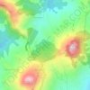
Budla-an topographic map
Click on the map to display elevation.
About this map

Name: Budla-an topographic map, elevation, terrain.
Location: Budla-an, Cebu City, Central Visayas, 6000, Philippines (10.35926 123.86594 10.39926 123.90594)
Average elevation: 919 ft
Minimum elevation: 177 ft
Maximum elevation: 2,172 ft
Other topographic maps
Click on a map to view its topography, its elevation and its terrain.






Kan-Irag Nature Park
Philippines > Cebu City > Pung-ol Sibugay > Kamandagan
Average elevation: 1,732 ft