Geolocate

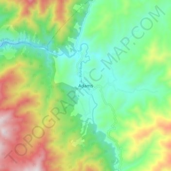
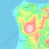
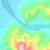
Adams topographic map

Click on the map to display elevation.

Adams

The shield was derived from the Provincial Seal of Ilocos Norte. The mountain range and the verdant field and river show the topography of the place as a potential source of wealth and livelihood and symbolizes the lofty ideals and the high hopes of the people for making Adams a place to live in.

Wikipedia (CC-BY-SA 3.0)

About this map

Name: Adams topographic map, elevation, terrain.

Location: Adams, Ilocos Norte, Ilocos Region, 2622, Philippines (18.42139 120.86157 18.50139 120.94157)

Average elevation: 1,709 ft

Minimum elevation: 489 ft

Maximum elevation: 3,907 ft

Other topographic maps

Click on a map to view its topography, its elevation and its terrain.
Pinili

Philippines > Ilocos Norte

Average elevation: 226 ft

Pagudpud

Philippines > Ilocos Norte

The town's topography includes mountains, hills, valleys and flat coastal land.

Average elevation: 240 ft

Brgy. 43- Cavit

Philippines > Ilocos Norte

Average elevation: 13 ft

Brgy. 11

Philippines > Ilocos Norte

Average elevation: 36 ft

Brgy. 6

Philippines > Ilocos Norte

Average elevation: 33 ft

Bojeador Cape

Philippines > Ilocos Norte

Average elevation: 374 ft

Badoc Island

Philippines > Ilocos Norte

Average elevation: 3 ft

Luna Park

Philippines > Ilocos Norte > Garreta

Average elevation: 52 ft

Paoay Lake

Philippines > Ilocos Norte > Suba

Average elevation: 85 ft

Saud Beach

Philippines > Ilocos Norte > Pagudpud > Saud

Average elevation: 36 ft

Gasgas River

Philippines > Ilocos Norte > Foz

Average elevation: 719 ft

Pagudpud

Philippines > Ilocos Norte

The topography includes mountains, hills, valleys, and flat coastal land. Maira-ira Beach is the northernmost tip of Luzon Island, located at 18°33′34″N 120°47′15″E / 18.55944°N 120.78750°E / 18.55944; 120.78750 on the Luzon Strait.

Average elevation: 240 ft

Pagudpud

Philippines > Ilocos Norte

The topography includes mountains, hills, valleys, and flat coastal land. Maira-ira Beach is the northernmost tip of Luzon Island, located at 18°33′34″N 120°47′15″E / 18.55944°N 120.78750°E / 18.55944; 120.78750 on the Luzon Strait.

Average elevation: 240 ft

Padsan River

Philippines > Ilocos Norte > Brgy. 53- Rioeng

Average elevation: 295 ft

Pagudpud

Philippines > Ilocos Norte

The town's topography includes mountains, hills, valleys and flat coastal land.

Average elevation: 240 ft
Pinili

Philippines > Ilocos Norte

Average elevation: 226 ft

Saud Beach

Philippines > Ilocos Norte > Pagudpud > Saud

Average elevation: 36 ft

Pinili

Philippines > Ilocos Norte

Average elevation: 226 ft

Brgy. 1

Philippines > Ilocos Norte

Average elevation: 33 ft

Gear up for your next adventure:

📷Action Camera - Capture your outdoor adventures in HD
🏥Hiking First Aid Kits - Comprehensive medical kits for remote trail injuries
⌚Solar GPS Watches - Advanced multisport watches with built-in topographic maps
🔭Compact Binoculars - HD vision for scouting terrain and identifying distant landmarks
🧺Microfiber Travel Towels - Compact and fast-drying towels for trail use

As an Amazon Associate, this site earns from qualifying purchases at no extra cost to you.