Geolocate

Darnu topographic map

Click on the map to display elevation.

About this map

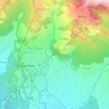
Name: Darnu topographic map, elevation, terrain.

Location: Darnu, Dharamshala, Kangra, Himachal Pradesh, 176200, India (32.19840 76.31219 32.23840 76.35219)

Average elevation: 4,616 ft

Minimum elevation: 3,543 ft

Maximum elevation: 6,952 ft

Other topographic maps

Click on a map to view its topography, its elevation and its terrain.

Balh

India > Himachal Pradesh > Dharamshala > Dharamshala

Average elevation: 6,253 ft

Gear up for your next adventure:

🪓Survival Multi‑Tool - Versatile tool for camp and trail tasks
💧Water Filtration Bottles - Safely drink from streams and lakes while exploring
🦟Ultrasonic Repellers - Create a bug-free zone at your camp or rest stop
🎁Geography Themed Gifts - Unique gift ideas for map lovers and geography enthusiasts
🗺️NatGeo Topo Maps - High-quality waterproof printed topographic maps of US Parks

As an Amazon Associate, this site earns from qualifying purchases at no extra cost to you.