
Marsing topographic map
Click on the map to display elevation.
Marsing
Marsing is located at 43°32′44″N 116°48′28″W / 43.54556°N 116.80778°W / 43.54556; -116.80778 (43.545484, -116.807811), at an elevation of 2,300 feet (701 m) above sea level. The city is on the Snake River, which forms the border with Canyon County.
About this map
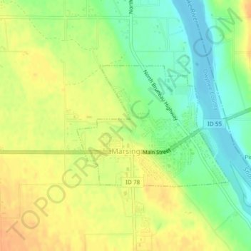
Name: Marsing topographic map, elevation, terrain.
Location: Marsing, Owyhee County, Idaho, United States (43.54162 -116.82051 43.55463 -116.79785)
Average elevation: 2,277 ft
Minimum elevation: 2,215 ft
Maximum elevation: 2,323 ft
Owyhee County trails, hiking, mountain biking, running and outdoor activities
Other topographic maps
Click on a map to view its topography, its elevation and its terrain.