Geolocate

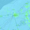
Steggerda topographic map

Click on the map to display elevation.

About this map

Name: Steggerda topographic map, elevation, terrain.

Location: Steggerda, Weststellingwerf, Frisia, Netherlands (52.83870 6.04665 52.88336 6.12099)

Average elevation: 7 ft

Minimum elevation: -7 ft

Maximum elevation: 33 ft

Other topographic maps

Click on a map to view its topography, its elevation and its terrain.
Leeuwarden

Netherlands > Frisia > Leeuwarden

Average elevation: 0 ft

Vierhuizen

Netherlands > Frisia > Allingawier

Average elevation: -7 ft

Oost-Vlieland

Netherlands > Frisia

Average elevation: 7 ft

Kooiplaats

Netherlands > Frisia > Buren

Average elevation: 3 ft

Loënga

Netherlands > Frisia > Loënga

Average elevation: 0 ft

Gear up for your next adventure:

📡GPS Antenna Upgrade - Enhance GPS reception in remote terrain
🎁Geography Themed Gifts - Unique gift ideas for map lovers and geography enthusiasts
🪑Portable Camp Table - Compact table for campsite meals
📱Heavy-Duty Phone Cases - Drop-proof and waterproof protection for outdoor navigation
🧭Hiking Compass - Precision compass for reliable navigation in the wilderness

As an Amazon Associate, this site earns from qualifying purchases at no extra cost to you.