Geolocate

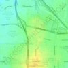
Evergreen topographic map

Click on the map to display elevation.

About this map

Name: Evergreen topographic map, elevation, terrain.

Location: Evergreen, Saskatoon, Saskatchewan, Canada (52.16097 -106.58357 52.17504 -106.55132)

Average elevation: 1,657 ft

Minimum elevation: 1,614 ft

Maximum elevation: 1,680 ft

Other topographic maps

Click on a map to view its topography, its elevation and its terrain.
Saskatoon

Canada > Saskatchewan > Saskatoon

Average elevation: 1,614 ft

Glacier Park

Canada > Saskatchewan > Saskatoon

Average elevation: 1,680 ft

Southwest Dog Park

Canada > Saskatchewan > Saskatoon

Average elevation: 1,654 ft

Gear up for your next adventure:

🧭Map Reading Tools - Tools and kits for map navigation
🏔️Mountain Trail Maps - High‑detail maps for popular peaks
🪶Thermal Camp Blanket - Extra warmth for cold nights
🏫Relief Map Kits - Hands-on tools for teaching landforms and elevation
📷Action Cameras - Rugged cameras to document your journeys across rugged terrain

As an Amazon Associate, this site earns from qualifying purchases at no extra cost to you.