
Laurel topographic map
Click on the map to display elevation.
About this map
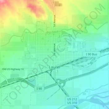
Name: Laurel topographic map, elevation, terrain.
Location: Laurel, Yellowstone County, Montana, 59044, United States (45.66104 -108.79056 45.68737 -108.72821)
Average elevation: 3,343 ft
Minimum elevation: 3,255 ft
Maximum elevation: 3,586 ft
Yellowstone County trails, hiking, mountain biking, running and outdoor activities
Other topographic maps
Click on a map to view its topography, its elevation and its terrain.