
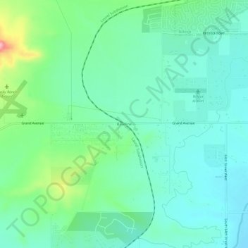
Baseline topographic map
Click on the map to display elevation.
About this map
Name: Baseline topographic map, elevation, terrain.
Average elevation: 3,422 ft
Minimum elevation: 3,297 ft
Maximum elevation: 3,809 ft
Other topographic maps
Click on a map to view its topography, its elevation and its terrain.
Billings
United States > Montana > Yellowstone County
Two-thirds of the city is in the Yellowstone Valley and the South Hills area and one-third in the Heights-Lockwood area. The city is divided by the Rims, long cliffs, also called the Rimrocks. The Rims run to the north and east of the downtown core, separating it from the Heights to the north and Lockwood to…
Average elevation: 3,369 ft
Billings
United States > Montana > Yellowstone County
Two-thirds of the city is in the Yellowstone Valley and the South Hills area and one-third in the Heights-Lockwood area. The city is divided by the Rims, long cliffs, also called the Rimrocks. The Rims run to the north and east of the downtown core, separating it from the Heights to the north and Lockwood to…
Average elevation: 3,356 ft