Geolocate

Irthlingborough topographic map

Click on the map to display elevation.

About this map

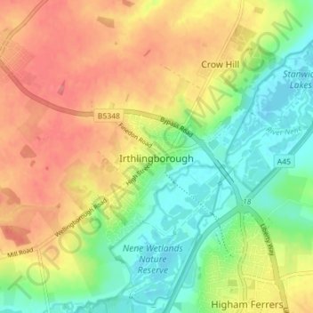
Name: Irthlingborough topographic map, elevation, terrain.

Location: Irthlingborough, North Northamptonshire, England, United Kingdom (52.30480 -0.64127 52.34796 -0.57863)

Average elevation: 217 ft

Minimum elevation: 105 ft

Maximum elevation: 328 ft

Other topographic maps

Click on a map to view its topography, its elevation and its terrain.

Lowick

United Kingdom > England > North Northamptonshire

Average elevation: 187 ft

Gretton

United Kingdom > England > North Northamptonshire

Average elevation: 266 ft

Laxton

United Kingdom > England > North Northamptonshire

Average elevation: 282 ft

Dingley

United Kingdom > England > North Northamptonshire

Average elevation: 361 ft

Wadenhoe

United Kingdom > England > North Northamptonshire

Average elevation: 157 ft

Corby

United Kingdom > England > North Northamptonshire

Average elevation: 338 ft

Pipewell

United Kingdom > England > North Northamptonshire

Average elevation: 407 ft

Rushton

United Kingdom > England > North Northamptonshire

Average elevation: 367 ft

Slade

United Kingdom > England > North Northamptonshire > Orton

Average elevation: 404 ft

Twywell

United Kingdom > England > North Northamptonshire

Average elevation: 233 ft

Weekley

United Kingdom > England > North Northamptonshire

Average elevation: 302 ft

Hargrave

United Kingdom > England > North Northamptonshire

Average elevation: 230 ft

Corby

United Kingdom > England > North Northamptonshire

Average elevation: 338 ft

Gear up for your next adventure:

🛡️Bear Spray Outdoor - Protection in bear country hikes
🔦Powerful Headlamps - Ultra-bright hands-free lighting for night navigation
📦Dry Bags Set - Waterproof storage for electronics and clothes
🦶Carbon Trekking Poles - Reduce knee impact on steep descents with ultra-light poles
🪑Portable Camp Table - Compact table for campsite meals

As an Amazon Associate, this site earns from qualifying purchases at no extra cost to you.