
Thank you for supporting this site ❤️
Make a donation
Make a donation
Gear up for your next adventure:
As an Amazon Associate, this site earns from qualifying purchases at no extra cost to you.
Carbon topographic map
Click on the map to display elevation.
Thank you for supporting this site ❤️
Make a donation
Make a donation
Gear up for your next adventure:
As an Amazon Associate, this site earns from qualifying purchases at no extra cost to you.
About this map
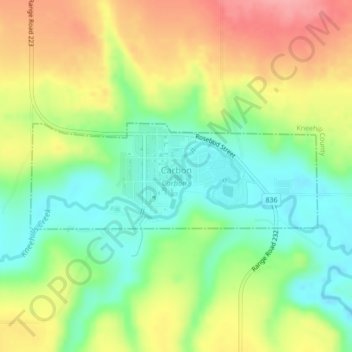
Name: Carbon topographic map, elevation, terrain.
Location: Carbon, Alberta, T0M 0L0, Canada (51.48140 -113.16963 51.48954 -113.13423)
Average elevation: 2,664 ft
Minimum elevation: 2,516 ft
Maximum elevation: 2,848 ft
Thank you for supporting this site ❤️
Make a donation
Make a donation
Gear up for your next adventure:
As an Amazon Associate, this site earns from qualifying purchases at no extra cost to you.