Geolocate

Pinamalayan topographic map

Click on the map to display elevation.

About this map

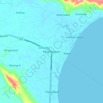
Name: Pinamalayan topographic map, elevation, terrain.

Location: Pinamalayan, Oriental Mindoro, Mimaropa, 5208, Philippines (12.99867 121.44016 13.07867 121.52016)

Average elevation: 56 ft

Minimum elevation: 0 ft

Maximum elevation: 751 ft

Other topographic maps

Click on a map to view its topography, its elevation and its terrain.

Inclanay Dam

Philippines > Oriental Mindoro > Inclanay > Pansulan

Average elevation: 95 ft

Bongabong River

Philippines > Oriental Mindoro

Average elevation: 1,972 ft

Bansud River

Philippines > Oriental Mindoro > Conrazon

Average elevation: 1,132 ft

Naujan Lake

Philippines > Oriental Mindoro > Malabo

Average elevation: 151 ft

Tawiran

Philippines > Oriental Mindoro > Calapan

Average elevation: 20 ft

Masipit

Philippines > Oriental Mindoro > Calapan

Average elevation: 13 ft

Lalud

Philippines > Oriental Mindoro > Calapan > Guinobatan

Average elevation: 26 ft

Gear up for your next adventure:

🧢Sun Protection Hats - Wide-brimmed and UPF-rated hats for high-altitude sun safety
📦Dry Bags Set - Waterproof storage for electronics and clothes
🪶Paracord Bracelet - Survival bracelet with built‑in tools
📖Nature Tracking Books - Learn to track wildlife and terrain
🔭Compact Binoculars - HD vision for scouting terrain and identifying distant landmarks

As an Amazon Associate, this site earns from qualifying purchases at no extra cost to you.