Geolocate

Mount Hope topographic map

Click on the map to display elevation.

About this map

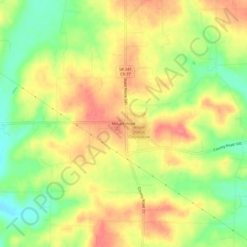
Name: Mount Hope topographic map, elevation, terrain.

Location: Mount Hope, Holmes County, Ohio, 44660, United States (40.60398 -81.80473 40.64398 -81.76473)

Average elevation: 1,194 ft

Minimum elevation: 1,053 ft

Maximum elevation: 1,312 ft

Holmes County trails, hiking, mountain biking, running and outdoor activities

Other topographic maps

Click on a map to view its topography, its elevation and its terrain.

Lake Buckhorn

United States > Ohio > Holmes County > Clark

Average elevation: 984 ft

Holmesville

United States > Ohio > Holmes County

Average elevation: 860 ft

Nashville

United States > Ohio > Holmes County

Average elevation: 1,191 ft

Gear up for your next adventure:

😴Insulated Sleeping Pads - Compact and warm pads for high-elevation camping
🚗GPS Dash Cams - Record your scenic drives through mountain passes and canyons
📻Weather Alert Radios - Stay informed of storm risks while off-the-grid
💧Water Purification System - Clean water on the trail with reliable purifiers
🧦Hiking Socks - Comfortable socks to prevent blisters on long hikes

As an Amazon Associate, this site earns from qualifying purchases at no extra cost to you.