Geolocate

Fort Shawnee topographic map

Click on the map to display elevation.

About this map

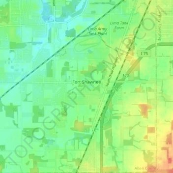
Name: Fort Shawnee topographic map, elevation, terrain.

Location: Fort Shawnee, Allen County, Ohio, 45806, United States (40.65740 -84.18000 40.71304 -84.10792)

Average elevation: 879 ft

Minimum elevation: 823 ft

Maximum elevation: 971 ft

Allen County trails, hiking, mountain biking, running and outdoor activities

Other topographic maps

Click on a map to view its topography, its elevation and its terrain.

Lima

United States > Ohio > Allen County

Average elevation: 876 ft

Gomer

United States > Ohio > Allen County

Average elevation: 778 ft

Westminster

United States > Ohio > Allen County

Average elevation: 965 ft

Allentown

United States > Ohio > Allen County > Lima

Average elevation: 820 ft

Conant

United States > Ohio > Allen County

Average elevation: 823 ft

Hume

United States > Ohio > Allen County

Average elevation: 853 ft

Kemp

United States > Ohio > Allen County

Average elevation: 840 ft

Landeck

United States > Ohio > Allen County

Average elevation: 794 ft

Maysville

United States > Ohio > Allen County

Average elevation: 1,007 ft

Rockport

United States > Ohio > Allen County

Average elevation: 814 ft

Scotts Crossing

United States > Ohio > Allen County

Average elevation: 784 ft

South Warsaw

United States > Ohio > Allen County

Average elevation: 928 ft

Southworth

United States > Ohio > Allen County

Average elevation: 810 ft

West Newton

United States > Ohio > Allen County

Average elevation: 1,037 ft

Gear up for your next adventure:

🌄Hiking Binoculars - Compact binoculars for scenic views and trail spotting
🧼Biodegradable Camping Soap - Eco‑friendly soap for outdoor hygiene
🧭Orienteering Set - Complete compass and map reading kit
🧥Men's Rain Shells - Premium waterproof and breathable jackets for mountain weather
🚪Portable Camp Chair - Foldable chair for comfort at camp

As an Amazon Associate, this site earns from qualifying purchases at no extra cost to you.