
Fort Reno Park topographic map
Click on the map to display elevation.
Fort Reno Park
The highest natural elevation at Fort Reno, 409 feet (125 m), is lower than the top of the Washington Monument, which rises 555 feet (169 m) from nearly sea level.
About this map
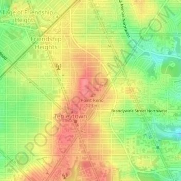
Name: Fort Reno Park topographic map, elevation, terrain.
Average elevation: 318 ft
Minimum elevation: 187 ft
Maximum elevation: 423 ft
District of Columbia trails, hiking, mountain biking, running and outdoor activities
Other topographic maps
Click on a map to view its topography, its elevation and its terrain.