
Durieu topographic map
Click on the map to display elevation.
About this map
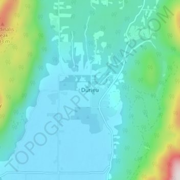
Name: Durieu topographic map, elevation, terrain.
Average elevation: 466 ft
Minimum elevation: 7 ft
Maximum elevation: 2,730 ft
Other topographic maps
Click on a map to view its topography, its elevation and its terrain.
Mamquam Icefield
Canada > British Columbia > Fraser Valley Regional District > Area F (McConnell Creek/Hatzic Prairie)
Average elevation: 6,316 ft
Isabel Lake
Canada > British Columbia > Fraser Valley Regional District > Area F (McConnell Creek/Hatzic Prairie)
Average elevation: 2,254 ft
Misty Icefield
Canada > British Columbia > Fraser Valley Regional District > Area F (McConnell Creek/Hatzic Prairie)
Average elevation: 5,906 ft
Misty Icefield
Canada > British Columbia > Fraser Valley Regional District > Area F (McConnell Creek/Hatzic Prairie)
Average elevation: 5,906 ft